 |
| Inside the Baring Store. |
 |
| Second breakfast - literally. I ate two breakfasts that morning. |
 |
| Lots of hikers hanging out at the Dinsmores |
 |
| Stevens Pass |
 |
| At the Stevens Pass trailhead, in my new jacket from REI (with reflective zipper lining) |
 |
| The weather wasn't too great. It was cold and overcast. |

 |
| Lake Valhalla |
 |
| The guide book had promised me a "waterfall". This is what I got. |
 |
| Don't ask. |
 |
| View from my tent vestibule. In the evening, it started to rain, and continued to do so during the night. |
 |
| Lake Janus, the next morning |
 |
| I knew from the forecast that the bad weather was not supposed to last. So every time it stopped raining, I thought, "Surely now it will be getting better!" Instead, it turned to this. Snow!!! On September 10th! |
 |
| When I had left Seattle two days earlier, it was 86 °F. Now it was snowing on me. |


 |
| Glasses Lake |

 |
| Occasionally, there were breaks in the clouds. |
 |
| A hiker I met on this part of the trail admired my "rain skirt". I was flattered. It's not every day that you receive compliments for walking around in a trash bag! |
 |
| Rainbow |


 |
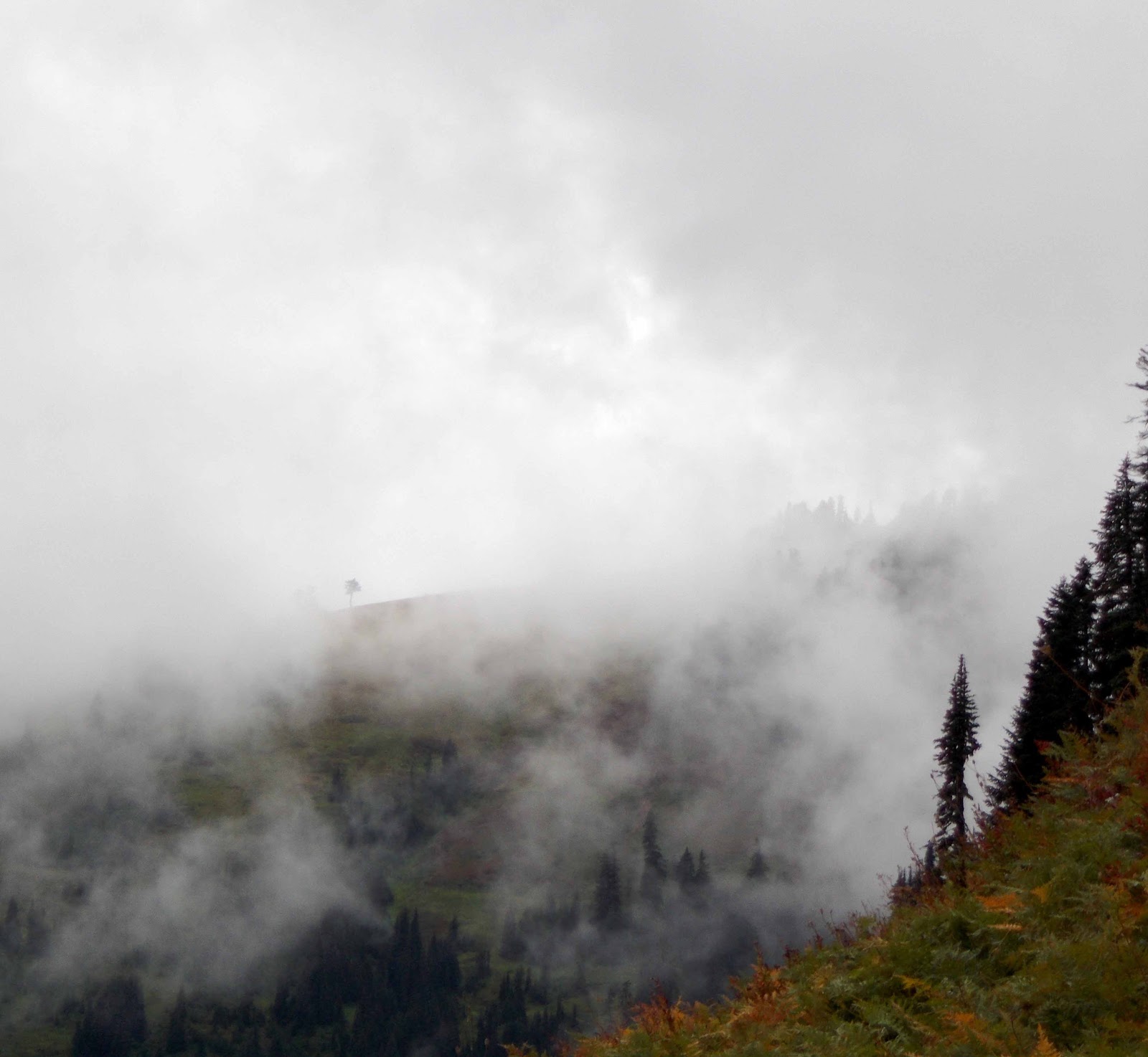
| Occasionally you would get a glimpse of how spectacular the scenery would have been, save for the clouds. |

 |
| The clouds were also pretty interesting in and by themselves. |
 |
| The reason I look so happy in this picture is that it had been an icy night - but I was still warm and comfortable! (Good thing I got those warmer clothes.) |
 |
| Even yesterday's rain drops were frozen solid. |
 |
| See? |
 |
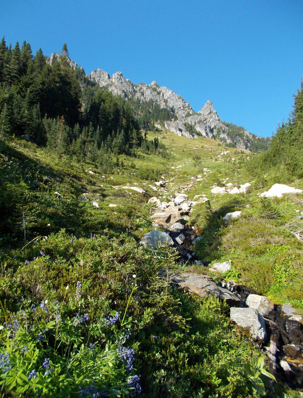
| Up on the ridges, it quickly became a beautiful day. |
 |
| Spectacular mountains in the distance |
 |
| ... and right ahead! (With fresh snow on them, too.) |


 |
| I would not have noticed this grouse at all if it had not started frantically making noises just as I walked by under its rock. |
 |
| Yes, you! |

 |
| Lake Sally Ann |

 |
| Drying out my things in the sunshine |


 |
| Indian Pass |
 |
| Lunch at Indian Pass |


 |
| Shortly before White Pass |


 |
| Sunset |
 |
| During the night, the wind shifted direction and started to blow in smoke from the forest fires to the east. |
 |
| It was noticeably hazier than the day before. |
 |
| Between White Pass and Red Pass |
 |
| Looking southwest from Red Pass |

 |
| View to the northeast from Red Pass |

 |
| Another marmot |

 |
| The valley beyond Red Pass |
 |
| Walking towards Glacier Peak |
 |
| Glacier Peak |


 |
| Kennedy Creek bridge. One of the commentators in my guide book called this a "bridge of modern design". Not sure if that was ironic?! |
 |
| Eroded riverbanks |
 |
| On the bridge |
 |
| Glacier Peak again |


 |
| Glacier Creek |


 |
| Approaching Fire Creek Pass, looking back southwest |
 |
| Fire Creek Pass |
+WEB+SMALLER.jpg) |
| View to the northeast |
+WEB.jpg) |
| View to the southwest |
 |
| I actually started crying up on Fire Creek Pass because it was just so insanely beautiful. Everywhere you looked, you were surrounded by beauty. |

 |
| Because of all the smoke in the air, it was another pretty hazy day. |
 |
| The peace and quiet of the wilderness were somewhat marred by two fighter jets barelling through. :-( |
 |
| Looking back at Glacier Peak |
 |
| Milk Creek and beyond. It was an intimidating view, knowing that you would have to descend into and then climb back out of all these valleys. (You could even see the switchbacks coming out of Milk Creek.) |


 |
| Mica Lake |

 |
| That rock had not always been there. It was sitting right on top of the trail! |

 |
| Washed out trail on the descent to Milk Creek. It was so steep somebody had fastened a rope on the other side to hold on to. |
 |
| Climbing out of Milk Creek wasn't much fun. Two hours of switchbacks on a badly overgrown trail, most of it in the afternoon sun. |
 |
| I finally made it to the top of the ridge. |

 |
| Glacier Peak, once again... (This time from the north.) |


 |
| Marmot, slightly confused by a whistling PCT hiker (I love whistling back at marmots. They never fail to look confused.) |
 |
| Ridge above the Dolly Vista campsite, looking northeast |
 |
| Evening clouds at Dolly Vista. It was one of the most beautiful camp spots on the entire trail. We even had a campfire! |
 |
| The next morning. Yup, that's the moon up there! |

 |
| Break of day |

 |
| Cultural confusion #375: Apparently Americans use a moon where Germans have a little heart... (I had been wondering what all these strange signs were.) |
 |
| Self-portrait with freshly washed hair. Because of the cold front coming through, I had not been able to wash my hair for five days. (Try sticking your head into a bucket of icy water when the weather is cold.) So when I woke up to find the air surprisingly warm again that morning, I jumped at the chance to clean up. It felt soooooooo good! |
 |
| I met a friendly pair of section hikers who took this picture of me. |
 |
| Descending to Vista Creek |

 |
| Junction to the new Suiattle River bridge. (The old trail had been blocked off, and somebody had added "No Log Xing" penciled onto the sign.) |
 |
| The new bridge across the Suiattle River. Five more miles of trail, but (at least for me) it's worth it not having to cross a raging river on a fallen log. |
 |
| Lunch break on the bridge |

 |
| Back at the Suiattle River |

 |
| One last look back at Glacier Peak |

 |
| South Fork Agnes Creek valley, from Suiattle Pass |


 |
| The rangers at Stehekin later told me that this was a pine marten. |
 |
| On the way to Stehekin |
 |
| The Stehekin River at High Bridge |

 |
| Lake Chelan |
 |
| Saying goodbye to Late Start and Second Chance |
 |
| Fearless deer walking around Stehekin |
 |
| NPS ranger giving a talk on pika: "After all, the world needs some cuteness!" |
 |
| Stehekin landing |
 |
| Looking north on Lake Chelan |


 |
| Hand Poet at the Stehekin post office. The whole building was crammed full of hiker boxes - hundreds of them! |
 |
| I signed Train's first & last wedding dress! He was a super-nice guy. |

 |
| I went kayaking on Lake Chelan. It was slightly intimidating to be out all alone on such a large lake, in such a small boat. |

 |
| Native American rock pictographs |

 |
| The ranger had told me to "just kayak across the lake and look for some white rocks." Amazingly, these directions were enough for me to find the pictographs. |
 |
| The wind kept blowing in more and more smoke from the forest fires in the east. |

 |
| The north end of Lake Chelan |


 |
| The kayak rental people had given me a waterproof radio, "just in case." True to form, I forgot it in the boathouse. |


No comments:
Post a Comment