Oregon Section D: Willamette Pass to McKenzie Pass (July 26-31, 2012)

Charlton Lake


Hanging out at Charlton Lake.  I got there early in the afternoon and had the
whole rest of the day to laze around.  It was wonderful to give my feet a rest
from my boots! (The thing that looks like I'm hooked up to an IV is my water
filter.)


Sunset at Charlton Lake

The next morning


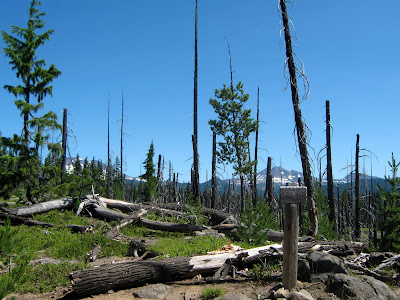
Burnt forest


Splintered tree


Many, many lakes...

Bunchberry


Cooking dinner at Cliff Lake

Morning fog

It had been a cold night.


Side trail to Elk Lake

I had some unforgettably good experiences at Elk Lake.  Things didn't start out
too well, though:  I was informed that the campground was full and the washer
broken; the only comfort to be had was a shower (and food, of course!).  But
when I started out across the neighboring Forest Service campground in search
of an empty spot, I came across an incredibly friendly couple who immediately
invited me to share their camp site.  They were so nice and friendly!  I chatted
with them and their kid for a while before taking off the next morning. 
Evan and Patty, thank you so much for your hospitality!

Elk Lake

The mountain in the background is the South Sister.

Kayaking on Elk Lake


Giving my feet a well-deserved break


Live music in the evening

Breakfast at Elk Lake Resort, and unforgettable Elk Lake experience #2:  I
was eating my breakfast when two nice ladies at the table next to me spotted my
pack and immediately wanted to know if I was hiking the PCT?  All by myself?
Was I carrying a gun?  I said no - I wasn't keen on getting into that discussion,
and I wouldn't have known what to do with one, anyway. After informing me that
"in this day and age, you should!", we all returned to munching our respective
breakfasts.  After they had left, the manager of the restaurant suddenly appeared
next to my table and told me that "those ladies just paid for your breakfast!" 
And they had already left, so I couldn't even say thank you to them! 
So if you ever come across this blog, here it is:  a big THANK YOU.  :-)


View to the northwest from Koosah Mountain

Approaching the South Sister


Wickiup Plain with South Sister


Mesa Creek


Middle Sister


This is where I lost the trail (again!).  I had been following
another hiker's footprints across the snow, trusting
vaguely that they had known what they were doing. Well...
apparently not!  I was only about half a mile away from the
lakelet where I had planned on camping for the night when
the footprints suddenly started veering off in a wide circle. 
It was close to sunset already, so I did not have much time
left to search for the trail.

Alpenglow on the South Sister

I eventually gave up trying to find the trail/lake and just set up camp in
whatever snow-free spot I could find.  (This is the next morning - my tent
to the right; the Middle Sister to the left.)

The lakelet would not have been a good place to camp
anyway.  It was still frozen over, and everything around
completely covered in snow.  When I finally found it, I
had to break through the ice to get at the water.


Can you see the trail?  Me either!!!

This was *way* too much snow without a GPS.  I eventually gave up trying
to locate the trail and just walked north cross-country for a mile or two.  To
this day I still don't know whether it was sheer dumb luck or my *ahem*
superior navigation skills that made me find the trail again.  It was definitely
an extremely unsettling feeling to have lost that little lifeline to civilization...

Looking back towards the South Sister

The Middle and the South Sister


Obsidian Falls


Obsidian

After slogging through what felt like endless miles of snow, I suddenly came
across a couple in shorts and bikini playing frisbee on the snow fields.  It was
a slightly surreal sight.


Looking north towards Mount Washington

Lava flow across from White Branch Creek

North Sister

White Branch Creek and the North Sister

I had barely done 8 miles when I got to White Branch Creek,
but pretty much all of them had been through solid snow,
and without knowing exactly where I was going.  I decided
that I had had it for the day and set up camp.  I was beat.

It was a beautiful camp spot.


The PCT winding its way through the lava flows

Collier Cone

Looking north


Looking back towards the North and Middle Sister

Yapoah Crater


This was one of the most exciting views for me on the trail.  For the first time,
I could clearly see where I was going - all the way to the OR/WA border!  Each
of these mountains here was a way mark on the PCT, and I was going to walk past
all of them:  Belknap Crater (the brownish hump on the left), Mount Washington
(that first "spike" with patches of snow on it), Three-Fingered Jack (the smaller
spike), Mount Jefferson (the big snowy mountain), and finally, Mount Hood (the
faint snowy triangle all the way in the distance).  What a view!


Butterfly

South Matthieu Lake.  A friendly day hiker gave me a peach here. 
It was perfect beyond words.   I dreamed of that peach for weeks after.

Looking back across the lava flows towards the North and Middle Sister

Highway 242 - McKenzie Pass, in the middle of the lava fields
(to the left:  the restrooms for the Dee Wright Observatory)

Dee Wright Observatory.  I think it looks like a lava dragon.

Each of the windows of the observatory was pointing to a
particular landmark.  This is the North Sister.

On top of the observatory.  Why do I always have my eyes closed?!


Looking back across the lava flows

More lava.  After miles and miles of walking on the stuff,
I was beginning to get a little tired of it.

No comments:

Post a Comment